
Introduction
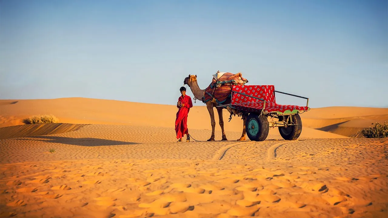
The Thar Desert (Rajasthan) or the Great Indian Desert is a distinctive arid terrain in the form of dunes, salt pans and ancient fort towns. The guide is small, targeted at three audiences at once: people travelling and need to know the routes and the security measures, fieldworkers who need clean GIS layers and printable maps, and publishers/cartographers who need to have a pack of maps ready to be hosted (A3/A4 PDFs, SVG, GeoJSON/KML, MBTiles). How-to instructions, conservation stories (Great Indian Bustard, power-line risks), as well as instructions on how to prepare the content to be published so that it can be both used in the field and found online, are provided.
- Quick facts & snapshot
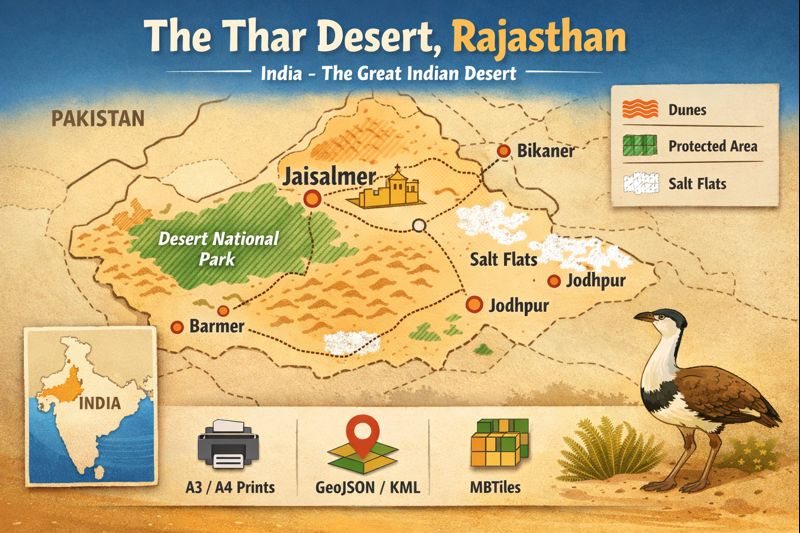
- Where is the Thar? — Location & landscape
- Climate at a glance
- Landscape features — what your map should show
- Flora & fauna — biodiversity tokens and conservation priorities
- Human history & culture — heritage tokens and local practices
- Practical field & survival tips
- Top attractions & activities
- Top sights
- Activities
- Printable map pack — recommended files & naming conventions
- How to use GeoJSON & MBTiles — simple, non-technical steps
- Open GeoJSON in QGIS
- Create MBTiles in QGIS:
- Load KML in Google Earth:
- Step-by-step: Build your Thar map pack
- Sample itineraries (easy table) — travel tokens
- Pros & Cons
- Pros
- Cons
- Design tips for printable maps (A3/A4) — cartography tokens
- Environmental issues & conservation
- Primary threats
- Conservation measures
- FAQs
- Conclution
Quick facts & snapshot
- Name (canonical): Thar Desert (Great Indian Desert)
- Core region: Mostly Rajasthan (India); fringe areas in Gujarat; extensive transboundary portion in Pakistan.
- Typical area (range): ~200,000–264,000 km² (variation due to boundary definitions).
- Key gateway towns: Jaisalmer, Jodhpur, Bikaner, Barmer.
- Notable protected area: Desert National Park (DNP) — ~3,162 km².
- Best season to visit: October–March (cool, dry).
- Major conservation concerns: Great Indian Bustard (critically endangered), habitat fragmentation, power-line collisions, invasive species (Prosopis juliflora).
Where is the Thar? — Location & landscape
The Thar is a wide semi-arid or arid strip of north-west India. It is bordered by the Aravalli Range to the east and the Indus plain to the west and south, respectively. The desert is spatially heterogeneous – it contains:
- Dune systems (mobile barchans, longitudinal dunes, stabilized dunes near vegetation),
- Rocky outcrops and pediments (inselbergs; small hills interrupting dune continuity),
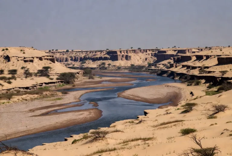
- Salt pans and playas (for example, Sambhar and Didwana — ephemeral, seasonally inundated),
- Ephemeral streams and tributaries (Luni River basin and seasonal drains),
- Vegetated patches and grazing lands (thorn scrub, riparian nodes around wells and ponds).
For mapping, each of these landscape classes is a distinct layer (dune polygons, dune crestlines, rock outcrops, playa extents, hydrology, settlements).
Climate at a glance
- Temperature: extreme summer highs (often > 45°C) and cool-to-cold winter nights (approaching freezing in some locations).
- Rainfall: low and highly seasonal — concentrated in the southwest monsoon (July–September). Annual totals range from approximately 100 mm (hyper-arid patches) to ~500 mm (semi-arid fringe).
- Wind & sand dynamics: persistent winds shape dunes; major aeolian activity occurs during dry, windy seasons. Post-rain vegetation flushes briefly and stabilizes mobile sands.
Landscape features — what your map should show
When designing visual products, include distinct symbology for the following:
- Dunes — polygon fills with dune crestline vectors for ridge orientation.
- Rocky outcrops / inselbergs — small shaded polygons / point markers.
- Plains & pediments — lighter fills with texture or pattern for hard surfaces.
- Salt flats/playas — dotted or stippled pattern to show Seasonal inundation.
- Ephemeral rivers/drains — dashed blue lines and seasonal flow attributes.
- Settlements — graduated point symbols sized by population or service level.
- Tracks and major roads — thin dashed lines (tracks) and thicker continuous lines (paved roads).
- Protected areas (DNP) — hatched or cross-hatched polygons with label.
Flora & fauna — biodiversity tokens and conservation priorities
Vegetation: thorn scrub dominated by Acacia spp., Capparis, Cenchrus grasses, succulents in xeric patches; riparian trees near dug wells and waterholes. Invasive species such as Prosopis juliflora alter native shrub structure and groundwater dynamics.
Wildlife: chinkara (Indian gazelle), blackbuck (where present), desert fox, various larks, sandgrouse, and raptors. Desert National Park is an Important Bird Area and historically home to the Great Indian Bustard (GIB) — a species prioritized for targeted habitat protection and power-line mitigation.
Mapping note: include wildlife-sensitive zones as overlay layers (GIB priority zones, nesting/lek sites, high-collision corridors near power infrastructure).
Human history & culture — heritage tokens and local practices
In the past, the region was located in the trans-regional caravan sailways. Fort towns (e.g. Jaisalmer, Bikaner) transformed into commercial and defence centres. Local livelihoods were modified to niche strategies: water harvesting (khadins, johads, step-wells), camel and goat pastoralism, artisanal crafts (textiles, mirrorwork, wood carving). Courteous visitation practices: seek permission before you take pictures of people, observe sacred places, and patronize local handicrafts where you find them.
Practical field & survival tips
- Water: carry 2–3 L per person per day (more in summer).
- Sun protection: wide-brim hat, sunglasses, SPF30+ sunscreen, long lightweight clothing.
- Navigation: use offline MBTiles/GeoJSON on phone apps as primary backup and an A3 printed map as secondary fallback.
- Transport: 4×4 recommended for dune fringes; licensed operators for organized camel or jeep safaris.
- Health: basic first aid kit, anti-insect repellent; know the nearest hospitals in Jaisalmer/Jodhpur.
- Permits & borders: western border areas may require permits — check local administration.
Top attractions & activities
Top sights
- Jaisalmer Fort & Havelis — living fortress with sandstone palaces.
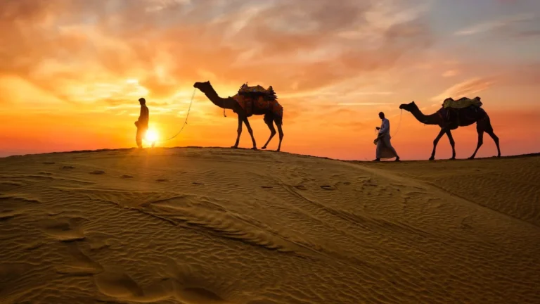
- Sam & Khuri dunes — iconic dune systems for camel and jeep safaris; sunrise/sunset camps.
- Desert National Park (DNP) — sand dynamics, wildlife, and fossils.
- Bikaner & Junagarh Fort — historic architecture and camel research facilities.
- Barmer — less touristed; rich craft traditions and quieter dune fields.
Activities
- Camel safaris (day and overnight).
- Guided jeep safaris into dune fields.
- Birdwatching in DNP and in seasonal wetlands.
- Cultural evenings (folk music, puppet shows).
- Photography — dawn and dusk produce the best soft, low-angle light.
Printable map pack — recommended files & naming conventions
A practical download pack should include both human-readable maps and machine-readable data. Suggested filenames and purposes:
| Filename | Purpose |
| thar-desert-rajasthan_a3_print.pdf | A3 printable map with legend & scale |
| thar-desert-rajasthan_a4_print.pdf | A4 printable map for field use |
| thar-desert_rajasthan_vector.svg | Layered vector for designers |
| thar-desert_rajasthan.geojson | Region GeoJSON: boundaries, dunes, protected areas |
| thar-desert_jaisalmer_slice.geojson | District extract (Jaisalmer) |
| thar-desert_mbtiles.mbtiles | Offline tiles (recommended zoom 5–12) |
| thar-desert_kml.kml | KML for Google Earth users |
| README.txt / LICENSE.txt | Usage instructions, CRS (WGS84), license (CC BY-SA recommended) |
Layer suggestions: base imagery, hillshade, roads, settlements, administrative districts, protected areas (DNP), dune polygons, salt pans, waterpoints.
Projection: WGS84 (EPSG:4326) for maximum cross-platform compatibility. Provide reprojection tips in README if you also supply local projected CRS (for print precision).
How to use GeoJSON & MBTiles — simple, non-technical steps
Open GeoJSON in QGIS
- Open QGIS → Layer → Add Layer → Add Vector Layer.
- Choose the .geojson file and click Open.
- Right-click the layer → Properties → Symbology → set polygon/line/point styles.
- Save style as .qml or export as PDF/SVG for print.
Create MBTiles in QGIS:
- Set up your map canvas with the desired layers and extent.
- Project → Export → Save as MBTiles.
- Choose zoom levels (e.g., 5–12 recommended) and export.
Load KML in Google Earth:
- Open Google Earth → File → Open → select .kml.
- Toggle layers on/off in the side panel, zoom to features, and use “Save Image” for snapshots.
Step-by-step: Build your Thar map pack
- Collect source layers: admin boundaries, dune polygons, roads, protected areas, waterpoints, elevation/hillshade.
- Attribute clean-up: use short field names (name, type, district, id). Remove redundant fields and normalize geometry.
- Design printable maps: A3 and A4 layouts with a clear legend, scale bar, north arrow, and an inset locator map. Include emergency contacts and ranger numbers.
- Export vector: layered SVG for designers — keep layers named and grouped (base, roads, dunes, labels).
- Export GeoJSON/KML: export a full region file and district slices (Jaisalmer, Barmer, Bikaner, Jodhpur).
- Generate MBTiles: choose tile cropping and zoom levels; test offline in a mobile mapping app.
- Compose README: short usage instructions, coordinate reference system, recommended apps, and troubleshooting.
- Choose license: e.g., CC BY-SA (allow reuse with attribution).
- ZIP & host: package downloads and host on CDN for performance; include thumbnails and preview images.
- Schema markup: add Article, Dataset, and HowTo JSON-LD to the download page for SEO features.
- CTAs & UX: Put primary download CTA (“Download A3 Map”) above the fold; include small preview thumbs and a short responsible-use note.
Sample itineraries (easy table) — travel tokens
| Days | Route & Highlights | Travel tips |
| 2 days | Jaisalmer: Fort → Havelis → Sam dunes (overnight) | Book a sunrise camel ride; short trip |
| 4 days | Jodhpur → Jaisalmer → Sam/Khuri dunes → DNP | Mix city, dunes, wildlife |
| 6–7 days | Jodhpur → Jaisalmer → DNP → Barmer → Bikaner | Best for offbeat exploration & culture |
Pros & Cons
Pros
- Unique scenery (dunes, forts, salt flats).
- Strong cultural traditions and craft economies.
- Good search interest for downloadable maps and GIS data — a good opportunity for publishers.
- Accessible hubs: Jodhpur and Jaisalmer.
Cons
- Extreme heat in summer — travel best October–March.
- Conservation sensitivities: critically endangered species (GIB), habitat fragmentation.
- Service variability in remote areas; some areas require permits.
Design tips for printable maps (A3/A4) — cartography tokens
- Simplicity: keep legend minimal and readable at printed scale.
- Fonts: use legible sans-serif fonts for small sizes; avoid decorative type for functional labels.
- Scale bar: include both metric and imperial if the audience is mixed.
- Locator map: a small inset that places the Thar inside India.
- Contrast options: offer both high-contrast and light versions for field visibility.
- Emergency info: local emergency numbers and ranger contacts in a corner.
- Accessibility: provide descriptive alt text for preview images and make lightweight downloads for low-bandwidth users.
Environmental issues & conservation
Primary threats
- Habitat loss from agricultural expansion and infrastructure (roads, power lines).
- Collisions with transmission lines — a major mortality factor for GIB.
- Invasive plants (Prosopis juliflora) that alter community composition and water balance.
- Unregulated tourism (vehicle erosion, litter, unmanaged camps).
Conservation measures
- Designate GIB safe zones and restrict high-risk infrastructure near these areas.
- Bury or shield power lines in priority locations.
- Promote community stewardship projects and low-impact tourism (leave-no-trace).
- Educate visitors via a one-page responsible-use PDF included in download packs.
FAQs
A: October to March — cooler and drier.
A: Not if you travel with a licensed guide and avoid unmarked deep dunes. Dune driving can be risky for inexperienced drivers.
A: Coverage is reasonable near towns but patchy in remote dune fields. Download offline maps and keep a printed backup for critical navigation.
A: Towns like Jaisalmer and Jodhpur have hospitals; remote areas do not. Carry a stocked first-aid kit and essential medicines.
A: Yes — but deep dunes and soft sand need experienced drivers and a 4×4. Consider hiring a local guide or operator.
Conclution
That is a very attractive destination and a valuable mapping project due to the combination of dramatic scenery, the rich culture, and the urgency of the Conservation. The tourists, researchers, and site managers will all be accommodated by a well-packaged map bundle (clear filenames, WGS84, README), and simple export instructions will be useful, as well as help preserve sensitive habitats. If you want, I can generate the actual files (A3/A4 PDF, GeoJSON slices, MBTiles, KML, SVG) and a README/license pack—tell me which items to produce first.